| GROWING CONDITIONS |
Russia experiences a wide range of growing conditions accross its 1,700 Million hectares of land area. Factors such as soil, climate and hydrology play a major role in determining how forests grow over the country. The concept of landscapes has been developed in Russia to attempt to classify the broad landscape into patterns that account for these various influences. This information is described in detail below. | Soil | Climate | Hydrology | Landscape |
Soil refers to the uppermost layer of the earth, which displays a specific morphological structure, chemical composition, physical and biological characteristics originating from the transformation of rocks under the influence of live and dead organisms, climate, age, forms of relief, and the activities of human beings. Russian naturalist V.V. Dokuchaev, who first recognized specific features of soil morphogenesis and regularities of geographical distribution, founded a basis for modern soil science that identified soil as an original natural body. Soil has fertility that is a combination of substances and water-air and temperature regimes that support biomass production under natural or managed conditions. Therefore, soil is an essential component of terrain ecosystems. Soil performs an important regulatory function maintaining the exchange of energy and matter between the biosphere, atmosphere, hydrosphere and lithosphere, which is essential for the development of life. | Map | Dataset | GIS | Description | For more detailed information on Soil refer to the Land Resources of Russia CD-ROM.
Climate is a long-term regime of atmospheric conditions, typical for a specified area. Climate is formed as a result of processes running in the atmosphere and fluctuates over time. The knowledge of climate is based on statistical analysis of the long-term observations of meteorological elements: atmospheric pressure, wind speed and direction, heat budget of the earth's surface, air temperature and humidity, cloudiness, and atmospheric precipitation. In this case, not only mean values of these elements are determined, but also their annual and diurnal course, extremes, and deviations from average quantities. Occurrence of certain weather phenomena, as well as the average and extreme terms of their appearance, are also noted. Complex indices, such as humidification, continentality, and others, are also used. For more details refer to the Climate section of the Land Resources of Russia CD-ROM.
The Russian Federation is the second country in the world, after Brazil, with the highest mean annual river runoff being formed over its territories as a result of snow melt and rain: a total of 4,043 km3/year. When taking into account the inflow from adjacent territories, the runoff resources become even greater: a total of 4,270 km3/year. The world’s largest rivers are to be found in Russia. They are the Yenisei (630 km3/year), the Ob (534 km3/year), the Lena (521 km3/year), and the Volga (238 km3/year). However, when calculated per unit of the water catchment area, the river runoff over the Russian Federation territory is more than 1.2 times smaller than the world's average values. The reason is that Russia is, on average, poorer in precipitation than other countries. In addition, water resources are very irregularly distributed over the territory. Mean annual values of river runoff vary from practically zero in the southeast regions of European Russia to more than 2,000 mm near the Main Caucasus ridge. For more detailed information on Hydrology refer to the Land Resources of Russia CD-ROM.
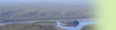
Russian natural sciences have accumulated great experience in territorial unit classifications and regionalization of land areas at various scales. One of the most general and promising approaches is the use of landscape philosophy, classifications and regionalization. The main idea is to divide land in homogeneous parts that could be linked to structure and functioning of land cover classes. According to Berg (1930), a geographical landscape is defined as “a total or a group of objects and phenomena, with certain regularities concerning relief, climate, water, soil, and vegetative cover, and animals, as well as human activities, repeated in a harmonized way over a definite land area”. We will consider in the following a number of different definitions and classifications, although all of them are united by one major idea – some territory of land is considered as an entity of all components with linkages between them and the presence of regularities, which are inherent in this entity. Hence, the concept of landscape represents aggregated knowledge of all natural conditions of a definite area. Although landscape classifications are comprehensive and could be applied at any scale, the “operational” level of landscape classifications (landscape type and smaller hierarchical units) are relatively small by area, which is why this approach is particularly useful for regional and subglobal studies. Related Documents:
| Copyright |Foreword | Acknowledgements | |


