

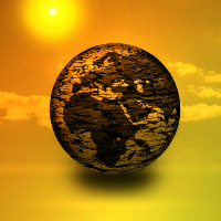
Nature Map Earth
This integrated map will allow decision makers at global, national and sub-national levels to identify priority areas to operationalize their targets for the conservation and restoration of nature.
The initiative will synthesize the best available data using methodologies that are globally consistent and draw on local information through consultative evaluation and validation. In this way, Nature Map Earth will help inform decision making at all levels (including CBD/UNFCCC, national, and sub-national) on what post-2020 biodiversity targets would imply. Both global and national perspectives are of course critical to the outcome of the post-2020 process. To maximize policy relevance at national and sub-national levels we will reproduce the data with the highest possible resolution. Mapped outputs will be made available at the time of the September 2019 United Nations Climate Summit with a view to provide timely input into negotiations leading to the 2020 Biodiversity COP.
Nature Map Earth will focus on synthesizing terrestrial data for biodiversity, carbon, and other ecosystem services. Building on the work of the Bending the Curve consortium of biodiversity modeling teams, which was launched by IIASA and others in 2017, the Nature Map Earth initiative will also explore geospatially explicit estimates of restoration potentials across the world. This initiative will also cooperate with National Geographic Society and other partners to combine terrestrial maps with geospatial data for ocean biodiversity and marine ecosystem services.
A particular priority of Nature Map Earth will be to enhance forest management data to support better policies for sustainable forest management and forest restoration that maximize benefits for biodiversity and climate change mitigation. To this end we will crowd-source forest management data through a Geo-Wiki as well as plant-species distribution data through a citizen-science campaign on iNaturalist. Together these campaigns will generate better forest management and species distribution data, which are both critical inputs for Nature Map Earth.
CONTACT DETAILS
Research Group Leader and Principal Research Scholar Biodiversity, Ecology, and Conservation Research Group - Biodiversity and Natural Resources Program
Senior Research Scholar Biodiversity, Ecology, and Conservation Research Group - Biodiversity and Natural Resources Program
Senior Research Scholar Novel Data Ecosystems for Sustainability Research Group - Advancing Systems Analysis Program
Senior Research Scholar Agriculture, Forestry, and Ecosystem Services Research Group - Biodiversity and Natural Resources Program
Senior Research Scholar Novel Data Ecosystems for Sustainability Research Group - Advancing Systems Analysis Program
Program Director and Principal Research Scholar Strategic Initiatives Program
Principal Research Scholar Novel Data Ecosystems for Sustainability Research Group - Advancing Systems Analysis Program
Citizen Science Campaign
Timeframe
01.2019 - 12.2020