

19 March 2015
Development of a global hybrid forest mask through the synergy of remote sensing, crowdsourcing and FAO statistics
A recent article published in the Remote Sensing of Environment Journal by IIASA researcher Dmitry Schepaschenko and colleagues highlights the first global forest cover map calibrated with FAO FRA statistics which is produced based on the integration of remote sensing data and crowdsourcing. All results are made freely available via the Geo-Wiki portal.
Follow the link to view the entire article.
Abstract:
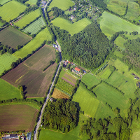
A number of global and regional maps of forest extent are available, but when compared spatially, there are large areas of disagreement. Moreover, there is currently no global forest map that is consistent with forest statistics from FAO (Food and Agriculture Organization of the United Nations). By combining these diverse data sources into a single forest cover product, it is possible to produce a global forest map that is more accurate than the individual
input layers and to produce a map that is consistent with FAO statistics. In this paper we applied geographically weighted regression (GWR) to integrate eight different forest products into three global hybrid forest cover maps at a 1 km resolution for the reference year 2000. Input products included global land cover and forest maps at varying resolutions from 30 mto 1 km, mosaics of regional land use/land cover products where available, and the MODIS Vegetation Continuous Fields product. The GWR was trained using crowdsourced data collected via the Geo-Wiki platform and the hybrid maps were then validated using an independent dataset collected via the same system. Three different hybrid maps were produced: two consistent with FAO statistics, one at the country and one at the regional level, and a “best guess” forest cover map that is independent of FAO. Independent validation
showed that the “best guess” hybrid product had the best overall accuracy of 93% when compared with the individual input datasets. The global hybrid forest cover maps are available at http://biomass.geo-wiki.org.
Highlights:
- Forest extent from 8 products was validated using crowdsourced data.
- The first global 1 km forest cover map (in contrast with tree cover) was elaborated.
- A hybrid forest map calibrated with FAO FRA data is produced.
- Both crowdsourced data and result hybrid maps are made publicly available.
