Crowdsourcing for post-disaster damage mapping
According to the Food and Agriculture Organization (FAO), natural disasters triggered by climate change have risen in frequency and severity over the last three decades. Between 2003 and 2013, natural disasters caused a total of US$ 1.5 trillion in damage worldwide. In developing countries alone, they cost about $550 billion in estimated damage and affected the lives of two billion people. Therefore, timely and innovative methods to rapidly assess damage to subsequently aid relief and recovery efforts are critical. In this field of post-disaster damage assessment, several crowdsourcing-based technological tools that engage citizens in carrying out various tasks, including data collection, satellite image analysis and online interactive mapping, have recently been developed. One such tool is Picture Pile, a cross-platform application that is designed as a generic and flexible tool for ingesting satellite imagery for rapid classification by volunteers. Picture Pile, initially developed to crowdsource deforestation mapping using very high resolution satellite imagery, has recently been adapted to support rapid post-disaster damage assessments as part of the Crowd4Sat initiative led by Imperative Space, in partnership with IIASA, Humanitarian OpenStreetMap Team (HOT), and the European Space Agency (ESA). The application provides simple microtasks, where the volunteer is presented with satellite images and is asked a simple yes/no question. A “before” disaster satellite image is displayed next to an “after” disaster image and the volunteer is asked to assess whether there is any visible, detectable damage. The question is formulated precisely to focus the volunteer’s attention on a particular aspect of the damage (i.e damaged buildings). The users can then quickly classify the images by swiping them to the right, left or down to indicate their answer respectively for yes, no or maybe, thereby efficiently completing the microtask. When thousands of microtasks are being completed by the crowd of volunteers over a very short time immediately after a disaster, the aggregated information on damage extent can help rapidly identify affected areas and significantly increase response efficiency on the ground.
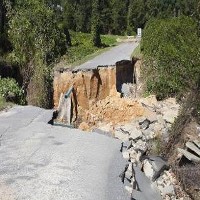
Following an initial crowd-powered test phase that uses example satellite imagery from large regions of Haiti affected by Hurricane Matthew in October 2016, the Picture Pile app is expected to be fully operational for rapid post-disaster damage mapping for future natural disasters. The project not only helps to increase citizen awareness of natural disasters, but also provides them with a unique opportunity to contribute directly to relief efforts.
The Picture Pile app is available for IOS, Android and in web browsers.
For more information:
Picture Pile: Gaming For Science
CONTACT DETAILS
Program Director and Principal Research Scholar Strategic Initiatives Program
Principal Research Scholar Novel Data Ecosystems for Sustainability Research Group - Advancing Systems Analysis Program
Research Scholar Novel Data Ecosystems for Sustainability Research Group - Advancing Systems Analysis Program
Research Scholar Novel Data Ecosystems for Sustainability Research Group - Advancing Systems Analysis Program
Timeframe
September 2016 - April 2017
RESEARCH PARTNERS
PUBLICATIONS


