

TrEco
Background
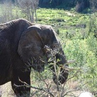
Ecosystems in the tropics differ from boreal, temperate and mid latitude ecosystems by several factors. High temperatures and precipitation levels are responsible for highly weathered soils with poor nutrient levels. Nevertheless, the tropical region harbors some of the most biodiverse ecosystems supporting high biomass levels. Tropical rain-forests resemble globally important Carbon stocks, but are also vulnerable to human management and impacts of climate change. Over exploitation and large scale clearing for agriculture may drastically reduce their Carbon carrying capacity leading to forest degradation, a switch to savannah vegetation or even barren land in case of erosion.
Due to the lack of data over large regions and the difficulty of experimentations one possibility is to turn to models to conduct numerical experiments. Models, however, need proper calibration and testing before they can responsibly be applied over large regions. For this reason, IIASA/ESM established and maintains the tropical ecosystems research plots network TrEco.
TrEco - plots
The TrEco research plots network contains field data from permanent and non-permanent research plots that were sampled and/or installed by IIASA researchers. It is dedicated to serve scientists within and outside of IIASA to compare model results with field data. Currently, TrEco consists of over 196 plots distributed across 8 different sites in Western Central Africa and covers typical tropical vegetation types and land use forms, including virgin forest refuges, exploited and managed forests, open and wooded savannahs, shifting cultivation and forest fallows as well as Agroforestry systems.
TrEco - data
The data from the plots consist of single tree dbh, height and wood density (in case of forest and wooded savannah vegetation), aboveground biomass and carbon content, species composition and derived indices on biodiversity, dead biomass, litter and soil carbon and nitrogen content, soil physical properties like texture, bulk density and depth, physical site properties including GPS coordinates, plot shape and size, elevation a.s.l., aspect and slope, as well as information on short and/or long term disturbance and land use history. Additionally, the methods of field sampling and lab analysis are documented.
Models using TrEco
The IIASA/ESM based BGC-MAN model was calibrated and validated with TrEco data for the dominant ecosystems and land use forms of the Congo basin, including virgin forests, managed forests, forest fallows after shifting cultivation and savannahs.
Links to other plot networks
All plots will participate in the ESA DUE Globbiomass Project , the plots covered by forest, Agroforestry and wooded savannah vegetation are also included in the IIASA based Forest Observation System (FOS) and plots located within exploited and/or managed forests are additionally part of the Tropical managed Forest observatory (TmFO).
