

IFPRI
IIASA has worked with IFPRI as follows:
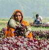
New global crop data aid in food policy decisions
IIASA cropland maps form the basis of a new interactive web site, which shows production of 42 crops at ten-kilometer resolution. More
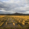
Finding farmland: New maps offer a clearer view of global agriculture
A new global cropland map combines multiple satellite data sources, reconciled using crowdsourced accuracy checks, to provide an improved record of total cropland extent as well as field size around the world. More
Systems Analysis Tools Framework for the EU Bio-Based Economy Strategy (SAT-BBE)
SAT-BBE studies the contribution of a bio-economy in different areas to ensure long term economic and environmental sustainability. More
Economic, Social and Political Conditions for Satisfying the World Food Needs (FoodSecure)
The FoodSecure project responds to the challenge of food shortages and volatility by enabling stakeholders to design sustainable strategies to assess and address the short- and long-term challenges of food security. More
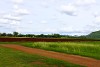
Quantifying global land resources
IIASA is involved in international cooperative efforts to produce accurate land cover and soil maps of the world, which are critically important for environmental and agricultural monitoring and decision making. More