

02 October 2017 - 04 October 2017
IIASA, Gvishiani and Wodak Rooms
H2020 LandSense Project First Annual Meeting
The consortium members of the LandSense project will meet in early October to review the progress of the project over the past year, and make plans for the upcoming year. The aim of this workshop is to detail the technical plans and citizen engagement activities for the upcoming pilot studies across Europe.
The pilots include:
- Vienna: Monitoring urban green spaces, in collaboration with TU Vienna and UBA, to facilitate improved urban planning for the city’s STEP 2025 plan
- Toulouse: Detecting and validating changes in land cover to support data needs of IGN, the French mapping agency
- Heidelberg: Promoting a series of mapathons with the OpenStreetMap community to update and validate changes in land use maps in peri-urban area
- Serbia: Collaborating with INOSENS to showcase the power of satellite data to deliver value-added services to farmers in the agricultural sector
- Spain: Triggering the BirdLife International volunteer network to help monitor protected areas for potential threats (i.e. anthropogenic, biological, climactic, etc.) to biodiversity
The workshop will be organized into plenary and breakout sessions to maximize overall partner engagement. In addition, the invited LandSense Expert Advisory Board will contribute to an open panel discussion.
The LandSense Project
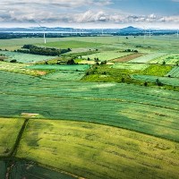
Currently within the EU’s Earth Observation monitoring framework, there is a need for low-cost methods for acquiring high quality in-situ data to create accurate and well validated environmental monitoring products.The purpose of the LandSense project is to build a far reaching citizen observatory for Land Use and Land Cover (LULC) monitoring that will also function as a technology innovation marketplace.
The LandSense Citizen Observatory aims to aggregate innovative Earth Observation technologies, mobile devices, community-based environmental monitoring, data collection, interpretation and information delivery systems to empower communities to monitor and report on their environment. Integrating these citizen-driven data collections with established authoritative and open access data sources will help reduce costs, extend GEOSS and Copernicus capacities, and support comprehensive environmental monitoring systems.
New LandSense services will be deployed across various pilots that will address critical LULC issues in the areas of urbanization, agricultural land use and forest/habitat monitoring. Policy-relevant campaigns will be implemented in close collaboration with multiple stakeholders to ensure that citizen observations contribute to EU-wide environmental governance and decision-making.
CONTACT DETAILS
Program Director and Principal Research Scholar Strategic Initiatives Program
Principal Research Scholar Novel Data Ecosystems for Sustainability Research Group - Advancing Systems Analysis Program
Principal Research Scholar Novel Data Ecosystems for Sustainability Research Group - Advancing Systems Analysis Program
Research Scholar Novel Data Ecosystems for Sustainability Research Group - Advancing Systems Analysis Program
PUBLICATIONS
Past Events
ECSA General Assembly 2017 and LandSense User Requirements Workshop
25 Jan 2017 - 26 Jan 2017
RESEARCH PARTNERS