

Crowdsourcing and gaming reveal land cover
Depiction of land cover data in different satellite products, especially cropland, is frequently uncertain. Many different products exist (e.g. Globcover, GLC-2000, MODIS, CCI, GlobeLand30) but their ability to represent the distribution of cropland globally in an accurate way is limited.
Geo-Wiki
Developed at IIASA, Geo-Wiki uses crowdsourcing for
collecting and verifying land-cover data using very high esolution imagery from Google Earth and Bing. Registered olunteers can sign up for campaigns to validate land cover, land use, and the degree of human impact. These data are then used in combination with existing landbased roducts to produce improved maps of global and cover. Geo-Wiki validation data are freely available to download.
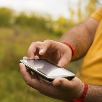
Games
IIASA is using games and social networking to build a citizen scientists network. For example, well over 2,500 people have participated in the IIASA game, Cropland capture, on tablet, mobile phone, and desktop computer, alidating over 2.5 million km2 of land cover data: half the size of the EU. Picture Pile is helping to map deforestation and to rapidly identify buildings damaged by hurricanes. FotoQuest Go is getting citizens out into the field collecting
land-cover and land-use data across Europe.
A new project, LandSense, is led by an IIASA scientist to develop a citizen observatory on land cover and land use. By involving citizens in monitoring urban land-use change, agricultural areas and forests, the costs involved can be vastly reduced, while empowering citizens to
contribute to a diversity of environmental issues. Case studies will take place in Austria, France, Germany, Serbia, Slovenia, Spain, and outside Europe in Indonesia.
Impacts
- Science plus gaming is the new frontier, and the IIASA Geo-Wiki project is at the forefront of gaming in the environmental context. The IIASA Cropland Capture game, where players travel through satellite images of the Earth looking for arable land, is spreading the word for the environment. It was listed among the top 10 education games of 2013 and featured by the BBC, The Economist, and The Guardian.
- In addition to interactive projects like Cropland Capture, Geo-Wiki also runs crowd-sourcing campaigns to collect data to help answer specific research questions such as land availability for biofuels, wilderness mapping, and assessment of land grabbing. Following research using crowdsourcing of Google Earth images in Geo-Wiki, scientists downgraded estimates of the land available for growing biofuel crops by up to 50%.
- A global map of the size of agricultural fields was created from crowdsourced data. This is the first global field size map ever created and is being used by the GEOGLAM initiative to monitor global agriculture and by researchers interested in quantifying the impacts of smallholder farmers on global food production and nutrition.
- The geographic reach of Geo-Wiki tools continues to expand. A mobile app for reporting crop diseases is being successfully used in Brazil. The Picture Pile game is being applied to identifying deforestation in Tanzania and Indonesia and for assessment of building damage in Haiti. The Geo-Wiki offline tool has been deployed to gather cropland data in Tanzania and Uganda.
- LACO-Wiki is the recommended land-cover and land-use validation tool for EU member countries to validate layers produced by the European Environment Agency as part of the Copernicus land monitoring service. LACO-Wiki can also be used to teach land-cover validation to students in remote sensing classes. Geography Geo-Wiki is used every year in undergraduate class assignments at the University of Waterloo, Canada.

Crowdsourcing and Gaming Reveal Land Cover (PDF)